In the wake of several high-profile uses of domestic drones as a means of product delivery, unmanned aerial systems have capture the collective conscious of the collective public. There are some that argue that drones may never see widespread commercial utilization because of their impracticality or that they will be regulated into insignificance by the Federal Aviation Administration. However, it is difficult to dispute that drones have several emerging domestic uses that promise to revolutionize industry in the US. Recent developments related to photography equipment make possible unparalleled footage to be captured from the viewpoint of the drone. Drones also have the potential to streamline the agriculture. Finally, by attaching sensors to these small vehicles, the environment and atmosphere can be monitored in places too dangerous for human-mediated data collection.
One of the most obvious domestic uses of drones is that of aerial video capture. Drones offer a glimpse of the world from a vantage point that was, until recently, entirely out of reach to the average videographer baring expensive helicopter-based photography rigs. Drones have seen relatively widespread utilization in recent years with the footage they shoot appearing in several TV shows and movies. However, drone use in the film industry has been severely limited due to Federal Aviation Administration policies barring the use of drones for commercial purposes. Recently, though, the FAA has been making headlines for its decision to allow six companies to utilize drones for express purpose of filming for professional video productions.
Unsurprisingly, the use of drone-assisted videography has not been limited to the professional circuits. With the ever dropping costs of small “action cameras” such as the GoPro line, hobbyists and professionals outside of the traditional film industry are recognizing the opportunity to use drones to their benefit. Hobbyists, ranging from extreme sports enthusiasts to naturalists, are realizing the unique perspectives that drones can provide and utilizing them to showcase places, people, and events. Similarly, drones have recently gained recognition as a tool for real estate agents, who can utilize the small, consumer-grade drones to capture still and video shots of houses from above, an angle that allows prospective home buyers to get a better feel for the way in which a home fits into the surrounding terrain. Again, real estate agents have, as of yet, faced the same limiting regulations that have stifled the movie industry from utilizing drones as widely as possible.
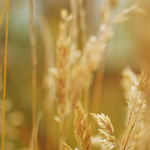
While hobbyist and professional use of drones for videography is notable, drone use stands to make a much larger impact in the farming and food production industries. In the US, farming takes place on such a massive scale that even minor inefficiencies can significantly affect harvest yields and resource consumption. Recent decades have seen the widespread adoption of the global positioning system (GPS) to streamline planting and harvesting while maximizing possible land use. Unfortunately, there is little in the modern farmer’s arsenal that can address the issue of plant health on a farm-wide scale.
Many argue that drones are the perfect tools to address this gap in so-called “precision” farming. Drones containing sensors, such as those used to track temperature humidity, and cameras capable of near-infrared vision can be used to gain insight into the health of plants. The quality, frequency, and precision of the data acquired using small unmanned aerial system is superior to all alternatives, most notably satellite imagery. In contrast to satellite imagery, the unmanned aerial systems utilized by farmers are often inexpensive enough for the farmer to purchase outright. Therefore, the farmer can make use of the technology as frequently as he or she would like. Additionally, since drones are designed to photograph the ground from below four hundred vertical feet, they offer high resolution imagery which is available at anytime, unlike satellite imagery which is often limited by cloud cover and the resolution of the cameras at launch.
It is clear that drone use in agriculture stands to revolutionize the way in which farmers address the issue of plant health. Near-infrared imaging equipment mounted on the bottom of consumer-grade drones can capture valuable data about the levels of chlorophyll present in the tissues of the plants, a key indicator of plant health. Utilizing these data, farmers can adjust parameters such as irrigation or fertilization to optimize plant growth while limiting waste. Due to the resolution of the imagery captured by drones, farmers make these optimizations on different sections of their fields, instead of applying the same treatment to the entirety of the field. Despite the many advantages of using drones to improve farming techniques and minimize waste, farmers too have felt pushback from the FAA.
Domestically, drones stand to make the largest impact in the field of environmental science and monitoring. The small size and agility of consumer and professional grade unmanned aerial systems make them perfect for monitoring the environment in areas too dangerous for humans to access. By attaching cameras and sensors, drones have already seen applications in monitoring atmospheric conditions above volcanoes, counting wildlife populations, and preventing illegal hunting. Drones will greatly augment the existing efforts of environmentalists and conservationists, two groups that are usually too cash-strapped to afford other means of aerial surveillance.
The data resulting from these operations will have implications in fields ranging from predictive climatology to population genetics. Data related to atmospheric composition in different geographic regions could lead to more accurate weather and climate models while accurate population counts and phenotype data could reveal previously unknown information about the breeding patterns of threatened or endangered species. The common thread between all of the environmental uses of drones is that they allow for necessary tasks to be completed without endangerment to human lives.
In 2010, two biologists and a pilot lost their lives when the helicopter that they were using to monitor salmon populations in Idaho’s Snake River crashed. Many now argue that if drones had been used in this exercise, three human lives could have been saved while collecting data which are just as accurate as those collected using a helicopter. The inherent danger of conducting field research in places where conditions are hazardous and medical care is distant provides a strong argument for the use of drones in the collection of environmental data.
As drones have gained mainstream recognition in the United States, many potential domestic uses have emerged, including those in videography, agriculture, and environmental monitoring. Unfortunately, FAA regulations have continually disrupted attempts to create commercial markets for drone usage. There may be a light at the end of the tunnel, however, as Congress has mandated that the FAA design and implement a set of legal guidelines governing the commercial use of unmanned aerial systems no later than September 30th 2015. Should the FAA choose to implement guidelines which favor the innovative use of drones, it is very possible that drones may become ubiquitous in the filmmaking, agriculture, and environmental industries.